Principal Investigator: Ekraj Sigdel (PhD Scholar)
My Role: Field Research Assistant (Biophysical & Socio-Economic Data)
1. Introduction and Landscape Context
The Barandabhar Corridor in Chitwan represents a critical ecological artery in Nepal, serving as a vital geographical bridge connecting the Chure hills to the Terai lowlands. This landscape facilitates critical wildlife movement while enduring severe anthropogenic pressures from surrounding urbanizing zones. As global conservation strategies shift toward Other Effective Area-Based Conservation Measures (OECMs), understanding the dual pressures of ecological integrity and community dependence within these spaces is paramount.
Working as a Field Research Assistant alongside PhD Scholar Ekraj Sigdel and a specialized five-member research team, we executed an intensive socio-ecological field campaign designed to map both the biophysical health of this corridor and the institutional perspectives of the communities that govern it.
2. Methodological Design and Stratified Sampling
A key challenge of socio-ecological research is ensuring that biophysical metrics align accurately with socio-economic data. Our team collectively designed a stratified field methodology targeting six distinct Community Forests (CFs) selected to isolate specific spatial and regulatory dynamics:
| Forest Classification | Sampling Location | Study Focus |
| Buffer Zone Community Forests (BZCF) | Chitwan National Park Buffer Zone | Wildlife interface and edge-effect pressures |
| Internal Corridor Forests | Inside Barandabhar Corridor | Structural connectivity and canopy density metrics |
| External Corridor Forests | Outside Barandabhar Corridor | Anthropogenic degradation and fragmentation baselines |
3. Biophysical Inventory and Sample Plot Establishment
To assess the ecological health of the forest patches, our team established permanent sample plots within the six selected community forests. The inventory process involved:
- Delineating Plot Boundaries: Laying out nested quadrants to evaluate tree species distribution, sapling regeneration, and biomass indicators.
- Dendrometric Measurements: Recording Diameter at Breast Height (DBH), total height, and canopy cover density.
- Understory Documentation: Classifying non-timber forest products (NTFPs) and invasive floral species that alter native ecosystem dynamics.
4. Socio-Economic Assessments and Community Engagement
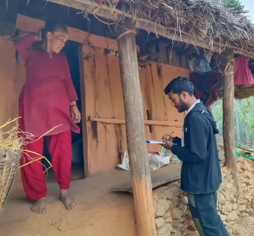
To capture the “social” half of the socio-ecological matrix, we transitioned from forest plots to human settlements. We targeted the Community Forest User Groups (CFUGs)—the frontline stewards of these ecosystems – using a two-tiered sociological framework:
- Household Surveys: We administered structured questionnaires directly to CFUG members. These surveys captured household dependency on forest products (fuelwood, fodder), local perceptions of wildlife conflict, awareness of OECM concepts, and views on changing climate patterns.
- Institutional Committee Consultations: We convened formal focus groups and meetings with the executive CFUG committees. These discussions illuminated internal governance challenges, benefit-sharing equity, and institutional alignment with state conservation policies.
This immersion provided deep insight into the complex socioeconomic realities of local resource users, highlighting how community-level equity directly influences ecological outcomes.
5. Post-Field Data Engineering and Analytical Pipelines
Data integrity in a mixed-method study depends heavily on data processing quality. Following the conclusion of our fieldwork, I transitioned to the role of data manager, handling raw datasets to ensure they were ready for advanced statistical testing:
- Data Cleaning: Designing validation rules to detect and eliminate entry anomalies, missing attributes, and measurement outliers between the social and biophysical datasets.
- Data Management & Structuring: Coding qualitative responses from the household surveys into standardized categorical variables to enable inferential testing.
- Analytical Assistance: Organizing structural data files into SPSS/R-ready matrix formats, allowing our team to cross-tabulate forest stand density metrics directly against community governance success indicators.
6. Reflection
This field campaign highlighted the value of true interdisciplinary conservation science. By integrating rigorous forest inventory techniques with contingent community interviews, this study provides a foundational blueprint for how OECM frameworks can be practically evaluated and implemented across Nepal’s critical biological corridors.
Co-designed methodology, established plots across six community forests in Barandabhar Corridor, conducted household surveys, and built an integrated socio-ecological governance dataset.