Trees Outside Forests (TOF) Assessment
Project Partnership: Forest Research and Training Centre (FRTC), Ministry of Forests and Environment, Nepal
Project Overview
Trees Outside Forests (TOF) play a critical role in carbon sequestration, agroforestry ecosystems, and local climate resilience frameworks. However, because they are scattered across agricultural lands and urban areas, they are historically under-mapped compared to continuous forest blocks.
This research focused on establishing a robust biophysical baseline for TOF resources in Nepal. The generated datasets directly support Nepal’s national climate commitments, including Nationally Determined Contributions (NDC) and Biennial Transparency Reports (BTR).
Methodology and Technical Contributions
Phase I: Geospatial Mapping and Visual Interpretation
- Spatial Scope: Covered the entirety of Madhesh Province and Lumbini Province.
- Platform: Collect Earth Online (CEO).
- Execution: Conducted rigorous visual interpretation of high-resolution satellite imagery across a gridded sampling design. Evaluated canopy cover thresholds, land-use classifications, and tree-cover presence to filter out non-target areas.
- Outcome: Successfully generated the stratified sampling frame and pre-selected tree-covered plots required to deploy ground-truthing teams efficiently.
Phase II: Forest Mensuration and Ground-Truthing Fieldwork
- Spatial Scope: Targeted inventory within three strategic districts of Madhesh Province: Bara, Parsa, and Rautahat.
- Field Protocol: Executed standardized forest resource inventory methodologies alongside the FRTC technical team.
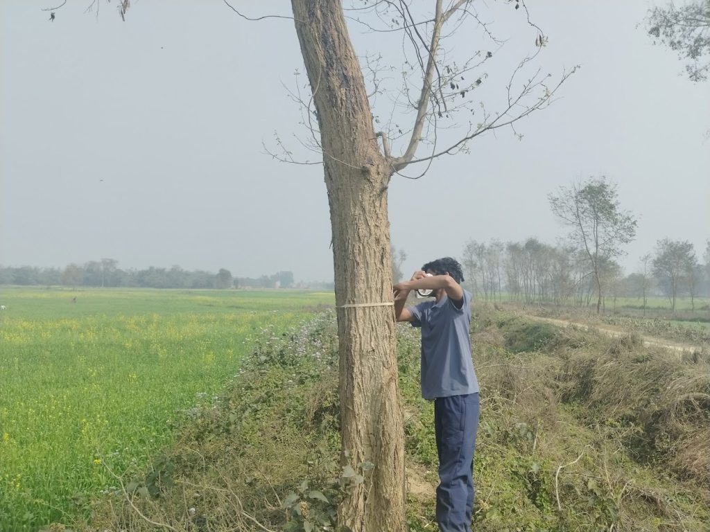
- Data Collection: Collected tree-level biophysical parameters within designated sample plots. Measured Diameter at Breast Height (DBH) and total tree height using specialized forestry instruments. Documented species composition (identifying dominant local taxa such as Mangifera indica and Dalbergia sissoo) and evaluated plot-level biodiversity indicators.
Phase III: Data Engineering and Quality Assurance (QA/QC)
- Execution: Spearheaded the end-to-end pipeline for data entry, cleaning, and structural organization of the raw field metrics.
- Data Wrangling: Reconciled taxonomic nomenclature errors from field sheets, audited structural anomalies, and systematically handled statistical outliers—such as massive, isolated religious trees (Ficus spp.)—to prevent skewing subsequent biomass calculations.
- Outcome: Delivered a clean, normalized, and validated dataset fully structured for species-specific biomass and carbon estimation models.
Core Competencies and Expertise Acquired
Geospatial and Remote Sensing Skills
- Proficiency in crowd-sourced GIS environments and visual interpretation using Collect Earth Online (CEO).
- Strong understanding of land-cover classification systems and remote sensing-based sampling designs.
Biometrics and Forest Mensuration
- Hands-on mastery of standardized forest inventory protocols and the operation of field equipment (calipers, densiometers, and laser rangefinders).
- Practical expertise in Terai eco-zone dendorology and the structural assessment of agroforestry systems.
Data Management and Analytics
- Advanced capability in data QA/QC, handling complex ecological datasets, and preparing raw fieldwork metrics for statistical software input.
- Skill in managing data integrity, filtering anomalies, and structuring data for carbon accounting equations.
Mapped trees outside forests using Collect Earth Online, conducted fieldwork in three districts, managed QA/QC pipelines, and supported national carbon accounting frameworks.